Tracking Satellites Based on the Dilution of Precision
- Apr 11, 2016
- Article
-
 Systems Tool Kit (STK)
The Dilution of Precision (DOP) is commonly used in satellite navigation to quantify the effects of positional measurements precision. Geometric DOP is used to determine how errors in measurements will affect the satellite’s final estimated state. It is defined as:


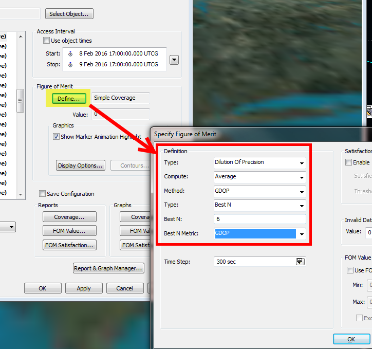
I can define the FOM to be the Dilution of Precision type and compute the average over the entire coverage interval. I want to use GDOP, choose the ‘Best N’ method, and set my ‘N’ value to 6.
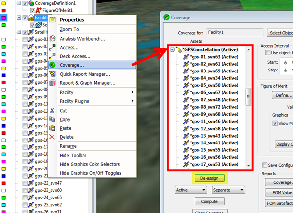
A GDOP of less than 1 is ideal, as this indicates a high confidence of precision. Small changes in the measured data will not result in large changes in the output location. STK has a built in DOP Figure of Merit (FOM) to measure the geometry of satellites and the quality of coverage. There are a number of DOP’s to choose from, including GDOP which measures the dilution of precision for the entire navigation solution (positional and clock-related components.) For this example, the STK scenario has a ground station that is only able to track 6 satellites at one time. With a GPS constellation, there may be more than 6 satellites in view of the ground station at a given time. How can we set up the scenario so that the ground station only tracks the 6 ‘best’ (lowest GDOP) satellites? To do this, I can use object coverage on my ground station with the GPS constellation as the assigned asset.


Once I’ve set these options, I can create graphs and reports that reflect this information.

