How to Use USGS Terrain Data in STK
- Oct 5, 2020
- Blog Post
-
 Systems Tool Kit (STK)
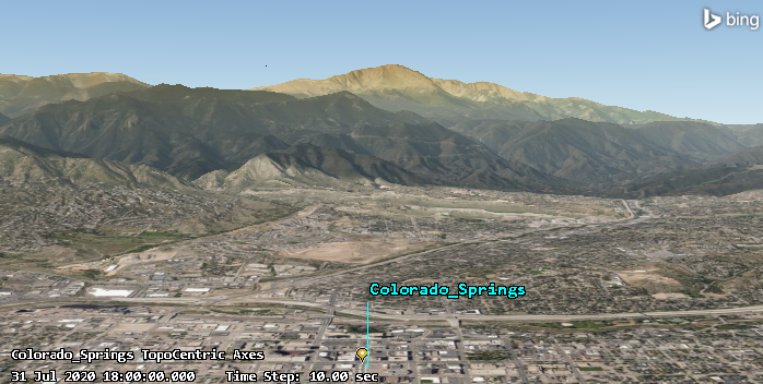
If you use Systems Tool Kit (STK) with online operations enabled, then you can automatically stream United States Geological Survey (USGS) terrain data from AGI's public Terrain Server. Creating a scene such as the one of my hometown, Colorado Springs, depicted below, is as simple as adding a Place object and setting your view in STK’s 3D Graphics window.
But even if you don't (or can't) take advantage of that streaming terrain service, you can still freely obtain and convert USGS terrain data to use it in STK. You can find step-by-step instructions for gathering terrain files from the USGS website to import into STK in our Tech Tips section. The video below will take you through the process outlined in the companion Tech Tip using terrain data for Boulder, Colorado.
Author

Systems Tool Kit (STK)
Modeling and simulation software for digital mission engineering and systems analysis.