Fun with Drones and STK
- Jul 5, 2021
- Blog Post
-
 Systems Tool Kit (STK)
My husband recently bought a drone – the Mavic Air 2. After looking at the rules for operating drones in Pennsylvania, we learned that we should not fly higher than 400 feet and that we should keep it within eyesight. The manufacturer’s specification gave an optimistic range of 10 kilometers. So, we took it to the highest hill on our property and started flying it around. We were curious though: how far could it really go, given that we live in a deep valley?
Enter STK
I built my scenario in a few minutes:
- Loaded local terrain from our TIM drive so that the computations would run quickly.
- Added my house using the “insert place from address” feature.
- Used 3D editing to move that place to our highest hill.
- Set the height above terrain to a few feet, otherwise these ground-based access calculations won't work!
- Applied a 10 km range constraint to my place object and enabled the terrain mask constraint.
- Added an elliptical area target centered at my place object with a radius of 10 km.
- Inserted a coverage definition and defined it by custom region, using my area target as the boundary.
- It is a small area, so I used a 0.25 km distance between grid points and placed them 400 feet above terrain. I assigned my place as the asset and then computed the coverage definition.
- Inserted a Simple Coverage Figure of Merit to see where I could fly. I also inserted a figure of merit of type "Access Constraint" and set the constraint to the range so that I could colorize by range from my place object.
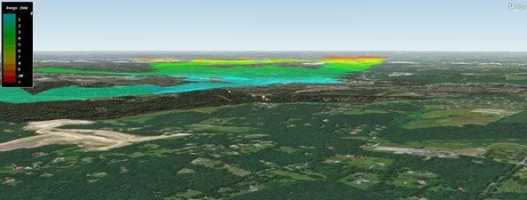
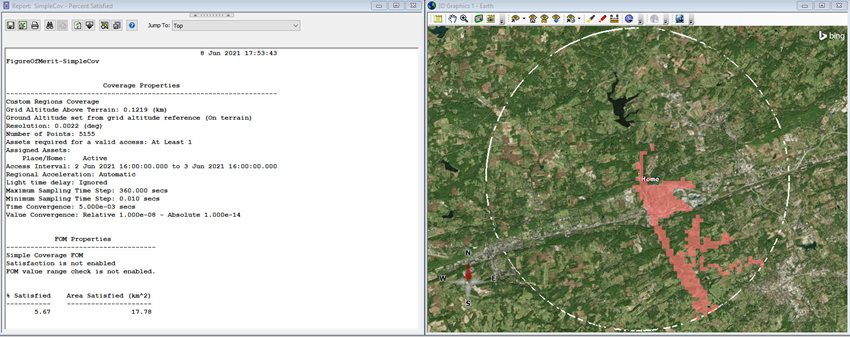
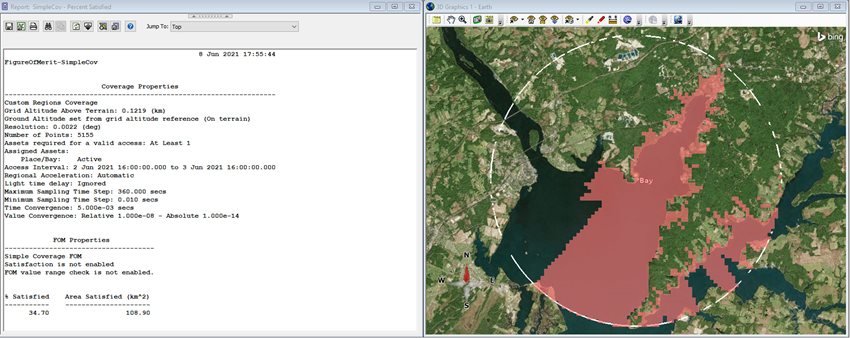
I can also see what percentage of my 10-kilometer radius area I can reach using the Percent Satisfied report for my Simple Coverage Figure of Merit. It's a mere 5.6%!
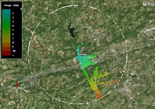
We also have a family house on the Chesapeake Bay, so I repeated the analysis for that location. It is far more open, so we can go all the way out to the 10-kilometer range limit.
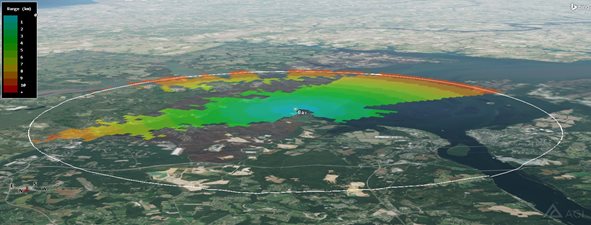
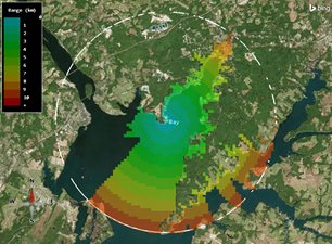
Our percent coverage is also much better at around 34%.
Of course, this is only using line of sight access constraints and the obstruction from terrain. In reality, there are interference effects from cell towers, boats, etc. that will degrade our signal. STK can model all this, but to do so I would need basic specs for the drone and controller antennas as well as the interfering sources. Overall, these results provided a great first approximation of where we could fly, although they don't include what is arguably our most constraining factor — the 30-minute battery life!
Author
Systems Tool Kit (STK)
Modeling and simulation software for digital mission engineering and systems analysis.