Using STK for Malaysia Flight 370 search analysis
- Apr 4, 2014
- Article
- Air Systems
-
 Systems Tool Kit (STK)

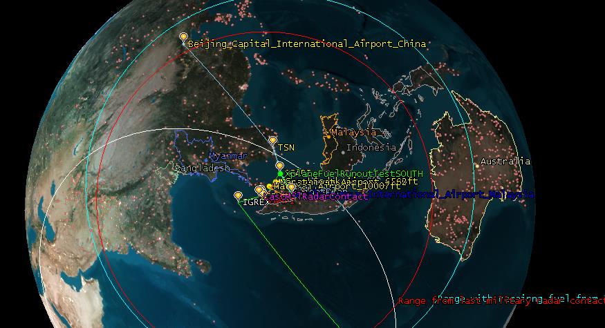
As the search for Malaysia Flight 370 continues, we've been using STK to create scenarios that can give us a better perspective of where all the assets are that are playing an integral part in piecing together the plane’s mysterious disappearance. If you watched the Smerconish show on CNN Monday night, you may have seen our friend and USGIF CEO Keith Masback discussing GEOINT's role in the search. The focus of Monday night's AGI animations were on Inmarsat versus Iridium satellites, but in terms of modeling space assets for a problem such as this, AGI software can be used to:
- Model the orbits of the geostationary satellites and calculate which satellite with capable sensors or receivers would have the path of the flight in their footprint.
- Model the transmitters and receivers on the satellites and aircraft.
- Model the orbits of the LEO satellites and sensor swaths based on mission type (e.g., imaging) and query potential in situ missions (such as environmental or weather) that may have seen the aircraft.
- Grid up the search areas and create coverage plots to understand the figures of merit from passing LEO satellites.
- Assign satellites and sensors.
- Model the known radar and communications facilities along the planned path of the aircraft and analyze who could/should have seen the flight and when. Query these operators specifically on possible data. This does not initially require high-fidelity data, just reasonable geometric volumes.
- Plot all ships in the area that may have had suitable radars (e.g., military) and create geometry representative of their sensors. Query these ships specifically for possible radar data.
- Using the planned aircraft route, run numerous routes in all directions and understand what other sensors, receivers, ships or aircraft could have seen the off-path aircraft.
- Create coverage grids of the search areas and perform coverage analysis using aircraft and ships.

The benefit of using modeling, simulation and analysis tools are to either turn up useful data on the aircraft's position and/or help eliminate certain paths and areas. This could help feed into progressive search approaches, such as Bayesian, which are updated based on new information. In particular, for an international search effort, the use of models and simulations can aid in collaboration to help optimize search resources. STK can be used to optimally schedule satellite sensor collections efforts across different types of satellites, orbits and sensor capability to achieve the best coverage. STK can do this tasking rapidly and dynamically to reallocate sensors when new information on higher probability areas is available. Finally, STK can perform aircraft fly-out modeling, and data such as flight simulator data can be brought into STK as “what if” scenarios to be run and analyzed in the STK environment. The software can be used to find:
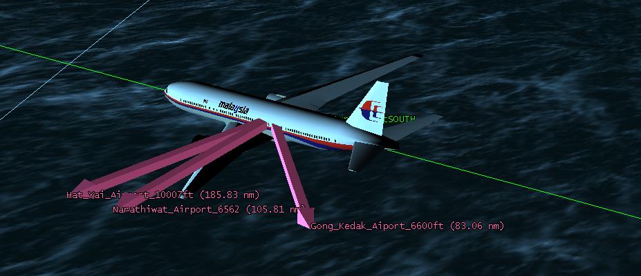
- Time/distance to suitable runways
- ADSB-transmit/receive modeling along the path of the scenario flight – if this was the route – then these receivers would have picked up the aircraft here (if transmitting)
- Fuel/range analysis
AGI - Malaysia Airlines MAS370 - Flight Path and Search Regions from AGI on Vimeo.

